The United States is often described as an agricultural superpower, capable of feeding both its own population and a significant portion of the world. From vast cornfields in the Midwest to cattle ranches stretching across the Great Plains, farming is a defining feature of the American landscape. But how much of the United States is actually farmland, and what qualifies as farmland in official statistics? Understanding the scale, structure and geographic concentration of U.S. farmland provides valuable insight into why American agriculture is so productive, especially when compared with countries such as Canada.
The Total Land Area of the United States
The United States has a total land area of approximately 9,833,517 square kilometres, making it the world’s third-largest country by total area. This immense size provides a wide range of climates, soils, and landscapes, many of which are well suited to agricultural production. While not all regions are farmable due to mountains, deserts, urbanization, or protected land, a remarkably large share of the country is used for farming in one form or another.
How Much Land Is Classified as Farmland?
Roughly 356 million hectares of land in the United States are classified as farmland, which is equivalent to about 3,561,638 square kilometres. This means that approximately 36.2 percent of the total U.S. land mass is used for agricultural purposes of some sort. In contrast, 6.2 percent of Canada’s land mass is used towards farming. This proportion is unusually high for a developed country of this size and reflects both favourable natural conditions, and the long-standing economic importance of farming in the U.S.
Farmland, as defined in U.S. agricultural statistics, includes land used for growing crops, raising livestock, and supporting agricultural operations. It does not include only intensively cultivated cropland but also pasture, grazing land, and other farm-associated areas.
What Counts as Farmland in the U.S.?
In the United States, farmland is defined and measured primarily by the U.S. Department of Agriculture (USDA) through its Census of Agriculture, which is conducted every five years. The USDA considers land to be part of a farm if it produces or would normally produce agricultural products intended for sale. This definition includes very small operations, provided they meet minimum sales or production thresholds.
READ: The Long Rise of California’s Almond Industry
The USDA divides land in farms into several distinct categories, each serving a different function within the agricultural system. According to the 2022 Census of Agriculture, cropland, making up 43 percent, includes land used for row crops such as corn, soybeans, wheat, and vegetables, as well as land temporarily left idle or in rotation. Pasture and rangeland, 45 percent, are areas used primarily for grazing livestock, especially cattle and sheep. Woodland, 8 percent, forms another important category and includes forests that are part of farm operations, whether used for timber, grazing, or environmental management.
Finally, a category known as “other land,” 4 percent, includes farm buildings, farmyards, roads, wetlands and areas not directly used for crops or grazing, but still integral to farm operations.
This classification structure is broadly comparable to Canada’s agricultural land use system, which separates land into cropland, summer fallow, tame or seeded pasture, and all other land. However, the U.S. system places greater emphasis on pasture and rangeland due to the scale of American livestock production.
Where Is Farmland Concentrated in the United States?
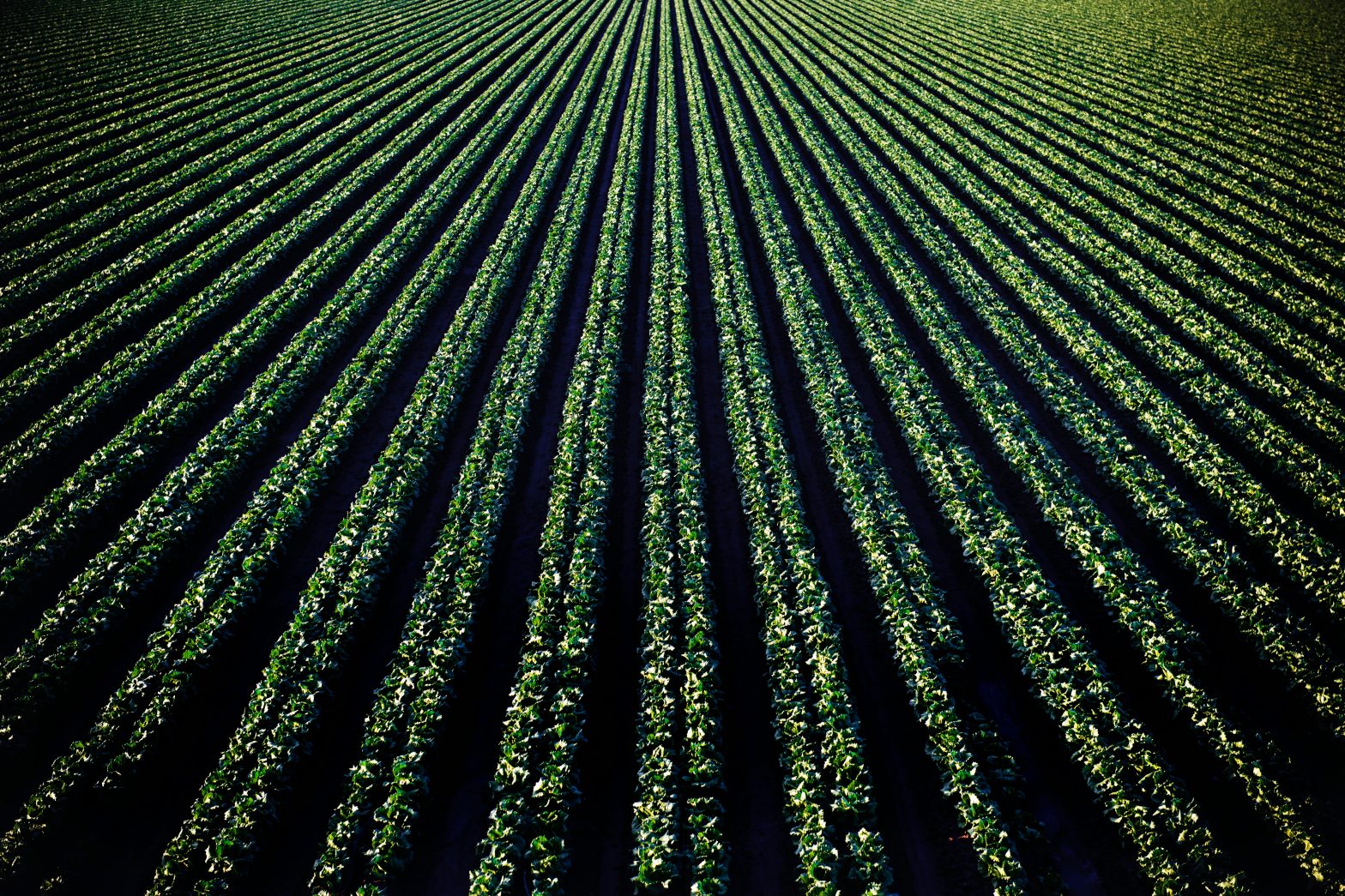
Farmland in the United States is not evenly distributed. The highest concentrations are found in the central part of the country, particularly the Midwest and Great Plains. States such as Iowa, Illinois, Nebraska, Kansas, and Minnesota are dominated by agricultural land, much of it devoted to large-scale row crop production.
The Great Plains, stretching from Texas north into the Dakotas, are characterized by extensive grazing land, and large ranches. This region accounts for a substantial share of U.S. pasture, and rangeland. The Mississippi River Basin, with its deep, fertile soils, supports some of the most productive cropland in the world.
READ: Why Are Used Tractors So Expensive?
Farmland is less concentrated in mountainous regions such as the Rockies and Appalachians, as well as in arid desert areas of the Southwest. Coastal regions and major metropolitan corridors also contain less farmland due to urban and industrial development.
Why So Much of the U.S. Can Be Farmed Compared to Canada
One of the most striking differences between U.S. and Canadian agriculture is the proportion of land that can be farmed. While Canada is slightly larger than the United States in total area, it has a much smaller share of farmland. This contrast is driven primarily by climate, geography, and soil conditions. For a more detailed analysis on Canada’s farmland read How Much of Canada Is Actually Farmland?
The United States benefits from a large contiguous landmass with long growing seasons across much of the country. A significant portion of U.S. farmland lies within temperate climate zones with reliable rainfall and warm summers. In contrast, large areas of Canada are constrained by short growing seasons, cold temperatures and permafrost, particularly in the north.
READ: Agriculture in Guam and the Northern Mariana Islands
Soil quality also plays a major role. The U.S. Midwest contains vast expanses of mollisols, some of the most dark and fertile soils on Earth, formed under grasslands, and ideal for crop production. Canada has fertile agricultural regions, particularly in the Prairie provinces, but they are more geographically limited, and subject to greater climatic variability.
Water availability further enhances U.S. agricultural capacity. Major river systems, extensive aquifers and large-scale irrigation networks allow farming in areas that would otherwise be too dry, particularly in states such as California, Arizona, and Nebraska.
Farms Versus Farm Size
While the United States has millions of hectares of farmland, this land is distributed across a wide range of farm sizes. According to the 2022 census, there are roughly 1.9 million farms in the country, but the majority of farmland is controlled by a relatively small number of large operations. An eye-popping statistic is that operations covering 5,000 acres or more represented only about 2 percent of all farms, yet they accounted for roughly 42 percent of the nation’s total farmland. At the opposite end of the spectrum, farms smaller than 50 acres made up approximately 42 percent of all operations, but occupied just 2 per cent of agricultural land.
READ: Why Are Idaho Potato Farmers Struggling So Much?
Average farm size in the U.S. is significantly larger than in many other developed countries, especially in grain and livestock producing regions. Large-scale mechanized farms dominate production of commodities such as corn, soybeans, wheat, and beef. Smaller farms, including speciality crop operations and mixed-use farms, are more common near urban areas and in regions with diversified agriculture.
This combination of extensive land availability and large average farm size contributes to high productivity and economies of scale, allowing U.S. farmers to produce large volumes of food efficiently.
Geological and Natural Barriers to Farming
Despite the large share of farmland, the United States does face geological and environmental barriers that limit agricultural use in certain areas. Mountain ranges such as the Rocky Mountains and the Sierra Nevada restrict farming due to steep terrain, shallow soils, and elevation-related climate challenges.
Deserts in the Southwest, including the Mojave and Sonoran deserts, present extreme heat and water scarcity, making agriculture heavily dependent on irrigation. While technology has allowed farming to expand into these areas, water availability remains a long-term constraint.
Wetlands, floodplains, and protected natural areas also limit where farming can occur. Environmental regulations have increasingly shaped how land is used, balancing agricultural production with conservation goals.
However, compared to many countries, the United States has relatively few absolute barriers that prevent large-scale farming across its core agricultural regions. The absence of widespread permafrost, extreme elevation, or fragmented terrain allows farming to occur over vast, continuous areas.
The Strategic Importance of U.S. Farmland
The scale of U.S. farmland underpins the country’s role as a global agricultural exporter. The United States is a leading supplier of grains, oilseeds, meat, and dairy products to international markets. This capacity is directly linked to the sheer amount of land available for farming and the efficiency with which it is managed.
READ: Saudi Arabia, the Desert Kingdom that Decided to Feed Itself
Farmland also plays a critical role in rural economies, land values, and national food security. As population growth, environmental change, and land development pressures increase, how U.S. farmland is managed and protected will remain a central policy issue.
Putting U.S. Farmland into Perspective
Approximately 36.2 percent of the United States’ total land area, or about 356 million hectares, is used as farmland, making it one of the most agriculturally intensive countries in the world. Farmland in the U.S. includes cropland, pasture, rangeland, woodland, and supporting farmland, reflecting a diverse and flexible agricultural system.
The concentration of fertile soils, favourable climates, abundant water resources, and limited geological barriers explains why such a large portion of the country can be farmed, especially when compared with Canada, its northern neighbour. Combined with large average farm sizes and advanced technology, this land base continues to support the United States’ position as a global agricultural powerhouse.
Which fact surprised you most: the size of U.S. farmland, the concentration in large farms, or the comparison with Canada? Let me know your thoughts in the comments section below.
Sources
- Government of Canada, Statistics Canada. (2022, May 11). Land use, Census of Agriculture historical data. Retrieved March 22, 2026, from https://www150.statcan.gc.ca/t1/tbl1/en/tv.action?pid=3210015301
- National Agricultural Statistics Service. (2024). Farms and farmland. In United States Department of Agriculture. Retrieved March 22, 2026, from https://www.nass.usda.gov/Publications/Highlights/2024/Census22_HL_FarmsFarmland.pdf
- US Census Bureau. (2021, December 16). State area measurements and internal point coordinates. Census.gov. Retrieved March 22, 2026, from https://www.census.gov/geographies/reference-files/2010/geo/state-area.html